


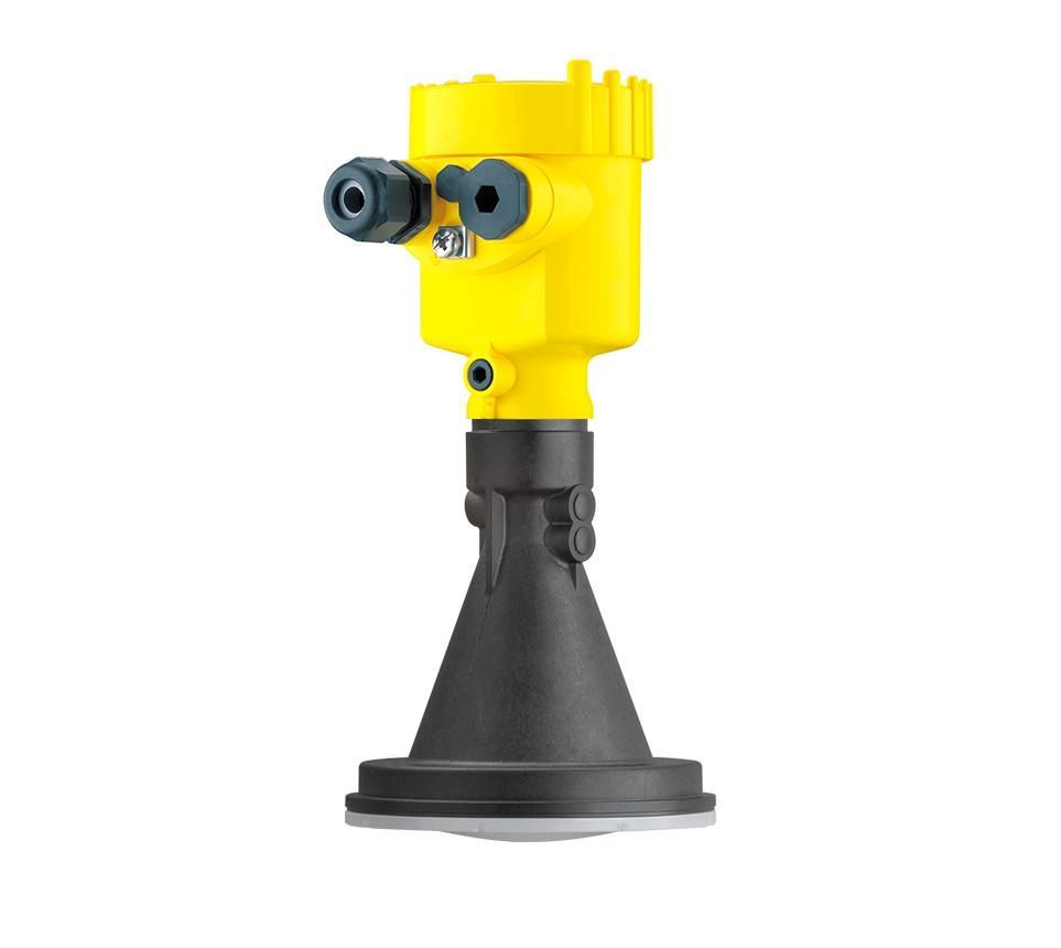
Water level radar (120 m)
Water level radar and data analysis with Smartyplanet
The SP69 water level radar is the ideal solution for measuring water levels in dams, ponds, rivers, etc.
The measurements are taken without being in contact with the water; therefore, radar maintenance is minimal.
The radar has high precision in its measurements and can measure up to 120m of water.
The data can be viewed through the Smartyplanet web platform as it is fully compatible with the radar.
Category: Water Level, Water Level, Smarty River, Smarty Water
Description
Applications
Technical characteristics
The SP69 water level radar is the ideal solution for continuous measurement of water level in dams, ponds, rivers, etc.
It can be equipped with an encapsulated plastic antenna or a lens antenna integrated into a metal flange. This allows for optimal adaptation to a wide variety of process conditions.
The device operates by emitting a continuous radar signal through its antenna. The transmitted signal is reflected by the product and received as an echo by the antenna. The frequency difference between the transmitted and received signals is proportional to the distance and, therefore, to the fill level. The fill level determined in this way is converted into a corresponding output signal and displayed as the measurement value.
This water level radar has a range of 120m and is accurate and reliable.
The equipment components in contact with the medium are made of 316L, PP, or PEEK. The process seal is made of FKM or EPDM. The housings are available in a two-chamber version in plastic, stainless steel, or aluminum. They are available in IP66/IP67 protection ratings.
The level radar is fully compatible with the Smartyplanet data visualization platform.
- Measuring water levels in lakes, dams, ponds, rivers, etc.
- Deep water level measurement
- Aluminum, plastic or stainless steel casing.
- 120 m altitude
- High precision
- Non-contact measurement
- Maintenance-free
Related products