


Smarty Snow: Avalanche prevention and control system, and winter road management
What is Smarty Snow?
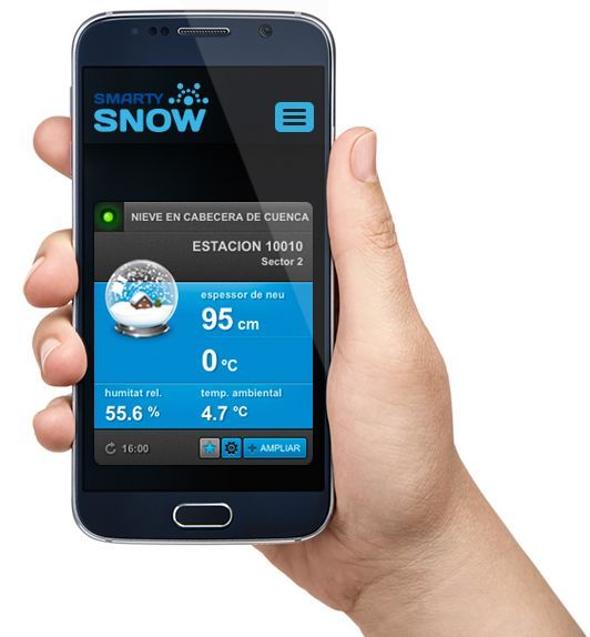
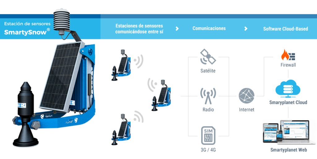
Smarty Snow is a comprehensive application that allows you to easily record, view, manage, and share environmental and snow industry data in real time. This data is collected by remote sensor stations and then sent to the web application.
This technology helps control the risk of avalanches in the mountains, preventing damage to infrastructure and ski resorts. It also reduces the current costs of manual measurements, allowing for many more measurement points, as it is more economical than existing solutions while maintaining the same reliability and accuracy.
Smarty Snow is a self-sufficient sensory solution integrated with social networks and is specifically designed to adapt to the demanding conditions of the winter sector.
Parameters controlled thanks to Smarty Snow
- Snow thickness.
- Snow surface temperature.
- Ambient temperature.
- Ambient Relative Humidity.
- Solar Radiation.
- Wind speed and direction.
- Rainfall.
- Other parameters that may be needed.

Plug and play installation

Without complicated infrastructure

Better cost-benefit ratio

Multiple sensors

Wireless communication

Unlimited autonomy

Resistant

Sensor networks

Web display

Super-reduced maintenance
Visually easy
Every single parameter controlled by the Smarty Snow stations is visible from the web platform.
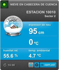
Snow control
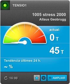
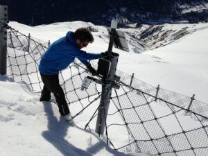
Tension of avalanche netting
Remote control
Rainfall
How Smarty Snow Works
Discover how Smarty Snow works
Benefits of Smarty Snow
- Monitor snow volume over large areas without the need for costly travel.
- Having access to historical data on the behavior and evolution of snow at ski resorts.
- Knowing the snow thickness at different points in real time and optimizing artificial snowmaking.
- Checking snow temperature from home for Nordic skiers.
- Remotely assess the condition of avalanche hazard zones and reduce the risk to people.

Snow is considered a highly valuable natural resource for recreational purposes. Ski resort users increasingly demand more information about their favorite sport, especially regarding the current snow depth, temperature, and weather conditions on each slope, so they can be well-prepared before leaving home.

On the other hand, snowpack in the mountains and headwaters represents a crucial water reserve that will be transformed into water during the warmer months. Knowing the volume of these snowpack reserves is essential for managing these water resources.
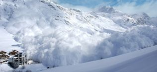
In recent years, access to the mountains by hikers during the winter season has increased. For this reason, land managers conduct avalanche risk monitoring campaigns and snowpack control measures to minimize the danger to people and infrastructure.
Success stories
Remote monitoring of avalanche protection networks in the Pyrenees
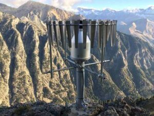
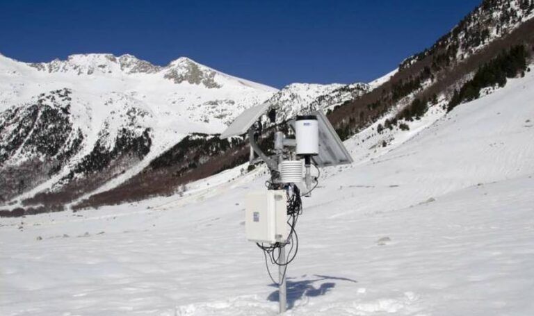
A fully autonomous, wireless SmartySnow station is installed, measuring snow depth, temperature, and humidity. An early avalanche warning system is also installed, using a load cell to measure the tension of the metal avalanche protection mesh.
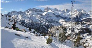
Supply and installation of a scientific-grade telesnow gauge station for avalanche risk management on the Canfranc road ("La Raca")
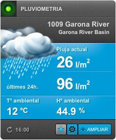
The station provides continuous, remote, and real-time information on snow depth, solar radiation, total rainfall, ambient temperature, and relative humidity. It is installed at an altitude of 2,200 meters above sea level, near the avalanche trigger zone. It is powered by photovoltaics and has a remote GSM connection.
Avalanche detection system and automatic closure of the access road to the Le Mourtis ski resort. Haute-Garonne. France
A fully autonomous, wireless SmartySnow station is installed, measuring snow depth, temperature, and humidity. An early avalanche warning system is also installed, using a load cell to measure the tension of the metal avalanche protection mesh.
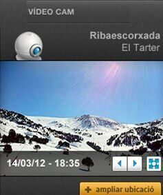
Snow and weather station and remote webcam for avalanche monitoring on the A-2606 road leading to Panticosa
A snow and weather station and a remote webcam are installed with the aim of monitoring adverse weather phenomena well in advance to avoid possible road closures and traffic accidents, as well as optimizing the maintenance of the A-2606 road leading to Panticosa.